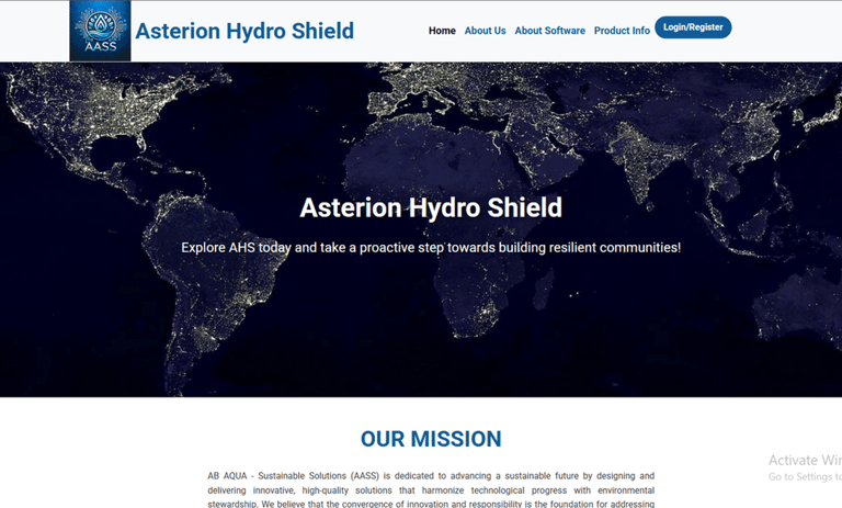
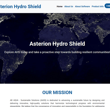
Asterion Hydro Shield
Asterion Hydro Shield (AHS) is a cutting-edge software platform for predictive analysis, developed to revolutionize the way geohazards are assessed and understood. As an advanced geohazard assessment tool, it integrates high-resolution environmental, climatic, geological, and socioeconomic data to offer a comprehensive, multi-layered understanding of hazard dynamics across diverse regions. Designed with scalability and adaptability in mind, Asterion Hydro Shield enables users—from environmental strategists and disaster risk managers to policymakers and infrastructure planners—to anticipate and prepare for complex, interlinked risks before they materialize into crises.
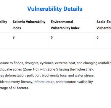
At the core of Asterion Hydro Shield lies a robust analytical engine that synthesizes both qualitative and quantitative datasets. This dual-method approach allows the software to go beyond simple numerical modeling and incorporate context-specific knowledge, local governance parameters, and cultural vulnerabilities. By doing so, AHS provides a more realistic and nuanced assessment of geohazard exposure and adaptive capacity. It evaluates a wide range of risk factors, including but not limited to climate change-driven anomalies, seismic instability, soil and slope degradation, hydrological disruptions, deforestation, and anthropogenic pressures such as urban sprawl and resource depletion. Each factor is not treated in isolation but rather as part of a larger, interconnected risk ecosystem, allowing users to visualize cascading effects and compound vulnerabilities over time.
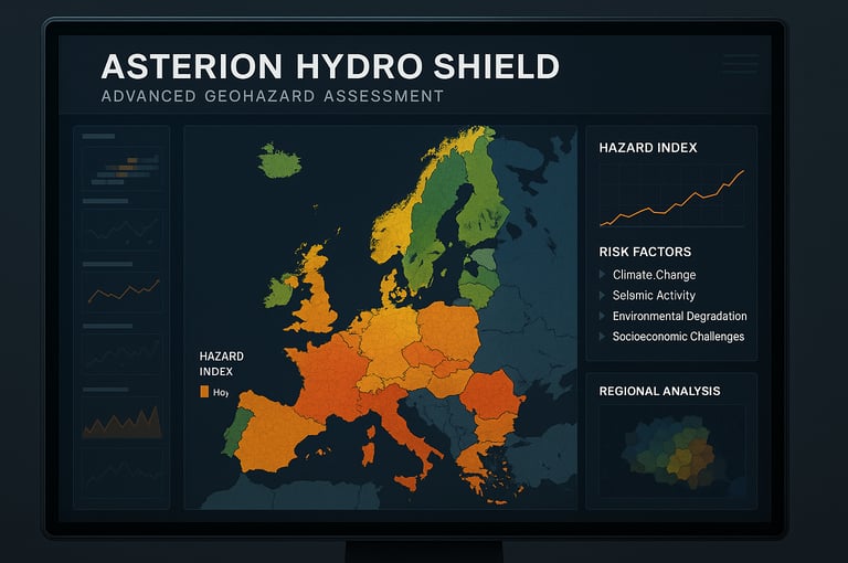
The predictive capabilities of Asterion Hydro Shield are powered by machine learning algorithms that continuously refine their outputs based on updated satellite imagery, on-the-ground sensor data, and open-source intelligence. Through a dynamic geospatial interface, users can explore risk maps, scenario simulations, and time-lapse projections that highlight both immediate threats and long-term vulnerabilities. These features make it possible to simulate how, for example, rising temperatures might increase landslide probabilities in tectonically active zones or how socio-political instability might exacerbate environmental degradation in drought-prone regions.
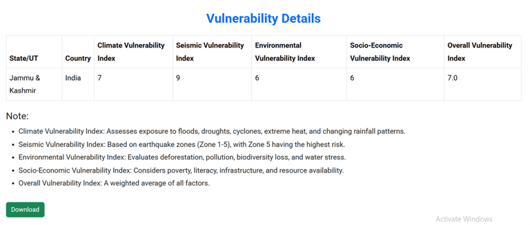
What sets AHS apart is its ability to produce customized hazard indices that reflect the unique physical and social characteristics of each area under study. These indices can be calibrated to reflect specific policy priorities, such as protecting water infrastructure, planning climate-resilient cities, or mitigating the risk of environmental displacement. Additionally, the platform supports scenario modeling for risk mitigation strategies, allowing users to test the impact of proposed interventions—such as reforestation, dam construction, or resettlement programs—before they are implemented.
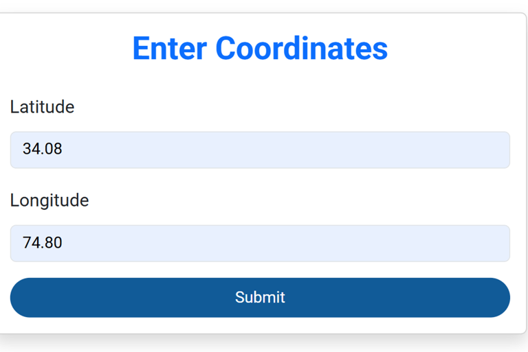
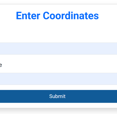
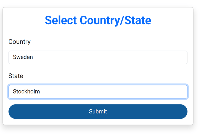
The use of Asterion Hydro Shield is remarkably intuitive and user-friendly. To initiate an analysis, users simply need to enter the geographic coordinates of the area of interest. Once the location is specified, the software autonomously activates its internal processing system, drawing on a suite of advanced calculation algorithms specifically designed to assess geohazard risks. These algorithms integrate environmental, hydrological, and climatic parameters to produce an accurate, real-time estimation of the percentage risk associated with droughts, floods, or broader water crises. This seamless process ensures rapid, data-driven insights, even for users with minimal technical background.
Based on the results generated by Asterion Hydro Shield, AB AQUA will deliver a comprehensive consultancy report tailored to the specific context of the area analyzed. This report will not only interpret the risk percentages and hazard indicators identified by the software but also translate these findings into actionable insights. It will serve as a strategic foundation for the development of evidence-based policy recommendations, guiding decision-makers in implementing targeted interventions to mitigate water-related risks such as droughts or floods. Through this approach, AB AQUA ensures that advanced predictive analysis is effectively transformed into informed policy and resilient planning.
The goals of Asterion Hydro Shield involve:
Comprehensive Risk Assessment: Provide an in-depth analysis of geographic vulnerability indices across different regions to inform risk mitigation strategies.
Empower Stakeholders: Provide governments, NGOs, researchers, and urban planners with actionable information to improve hydro-strategic preparedness and resilience.
Proactive Decisions: Enable data-driven decisions to anticipate and mitigate the impacts of natural and socioeconomic challenges.
Support Sustainable Development: Promote sustainable development by monitoring environmental degradation and socioeconomic factors.